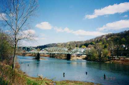
West Newton
Beyond Sutersville you will pass through Smithdale and Collinsburg - two small railroad towns similar to Industy and Blythdale. The only deep mine in the area is near Smithdale. At MM 33 you come to West Newton which is situated on Rte. 136.
- Parking
- portapotty
- Bike shop adjoining parking lot
- Bike rental
- Bike storage
- repair
- Drug store & deli up the street
At the crossing at West Newton - be careful because the street is a busy one - you will see a half refurbished railroad car. This will eventually be one of the trail headquarters.
Beyond West Newton is little Buddtown - you'll hardly notice it, but there is a kind resident next to the trail who keeps a trough filled with water for horses who trot the trail, or for dogs of walkers.
On your right, just beyond Buddtown, is the remains of the Banning #4 Coal Mine. The building is fast deteriorating, but the huge slag heaps will be there forever.
The "holey" rock
Just before Cedar Creek, the trail runs along a bench cut between a steep cliff on the right, and one of the left which slopes towards the river. There, if you are lucky and your eyes are sharp, you will see the "holey" rock. (we see it in one year out of 3, and we know where to look!)
Like the red falls, this is an unofficial feature of the trail - and can only be seen in early spring or late fall; it is otherwise obscured by heavy foliage.
What caused this particular rock to erode this way? It is like no other on the trail.
It is at MM36
|